 | |
| day-14.gpx | Gogle Maps GPX Viewer |
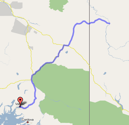
Valdez, AK to Dawson City, YT
Lots of miles covered today—it was unclear, before trying it, that this route was even possible. And yet, here we are, magically still on schedule. This morning we jumped out of bed at 7:00 and were on the road by 8:00. More Nutri-Grain bars for breakfast. Drove out of town, past Old Valdez (we couldn't really see anything from the highway) and through the canyon and up to Thompson Pass, where we stopped for panoramic photos and again at Worthington Glacier (just over the summit), where we busied ourselves with a half-hour of scrambling over shale to reach and touch the ice. I'd call it time well spent, even on our tight schedule. We continued on, descending into the Copper River valley, where three huge volcanoes—Mts. Drum, Sanford, and Wrangell—dominated the view east and south as we drove through flattish wooded counry, meeting the Glenn Highway at Glennallen and then turning off on it at Gakona, bound for Tok. Mt. Drum has a glaciated, broken look. Mt. Sanford, in the middle, is over 16,000 feet tall and very pointy and jagged. But Mt. Wrangell, the furthest east, is a huge flat dome of a thing that we thought was a cloud before we reached the viewpoint over the Copper River and realized that it was, in fact, a massive shield volcano, built up by lots of oozing lava like Mauna Loa. It couldn't be more different from the other two if it tried. This is the kind of thing I love to see—and imagining these as the northernmost tip of the Cascade volcano chain, following the Ring of Fire along the edge of the Pacific Plate, is lots of fun. From here to Mt. Shasta and Mt. Lassen only feels like a skip and a jump, in a way.
Lots of construction on the Tok Cutoff slowed us down, but only a little—it was all hard chip-seal. About two hours after Gakona, as we wound our way through the canyons of the Alaska Range, we saw the first signs of straight wooded road looking very much like we'd seen in Tok a week before—and, less pleasantly, of the thick pall of forest fire smoke that would dog us all the way to Dawson. We gassed up in the now-familiar Tok, then backtracked 12 miles along the Alaska Highway to Tetlin Junction, where we turned off towards Chicken and Dawson. I'm sure the road would have been beautiful, if it hadn't been for the smoke blanketing us and preventing us from seeing to the next ridge, or for the charred forests on both sides standing as evidence of last year's burn. But we got to Chicken without incident; stopped in and got a late lunch and some souvenirs (for Van and others), absorbing as much as we could of the vaunted culture of this one-building town with its twenty-something year-round residents. They don't have phone service, and mail comes twice a week, but they do have Internet and Wi-Fi. Also they take credit cards—the kid running the grill said he just has to drive the cash box down to Tok once a week to call in all the receipts. We took pictures and used the outhouse ("Chicken Poop"); then we pressed on.
The road became dirt/gravel after Chicken, rising through sometimes precipitous canyons with sharp switchbacks, and the smoke got thicker and thicker as we neared the border. (Apparently the fire was within 8 miles of Boundary. I suppose this happens every year.) Customs, in a real live border checkpoint facility instead of the trailer I'd been told housed it in years past (though it still closes at 8:00 on the Alaska side), was surprisingly stern, insisting that Paul give his own accounting of when we entered Alaska; good thing he's been keeping these notes and receipt tallies! The road became chip-seal with gravelly construction patches on the Yukon side, and the trees almost completely disappeared; what with the smoke, it made for a very eerie, lunar-looking landscape. Also we saw a porcupine waddling along the side of the road.
The Jetta's EPC light came on just after the border, solid; then it went off again a minute later. Maybe it was the smoke. This happened, by the way, at the most remote and inaccessible spot in the entire vacation. Exactly where I'd dreaded it would. I think maybe it was a combination of the smoke, dust, and altitude that made it happen, because it hasn't recurred. (Note from two weeks later: it was the brake light switch, a completely non-critical system, choosing exactly this moment to decide to start failing purely in order to freak me out.)
Finally we saw signs welcoming us to Dawson City and descended into the Yukon River canyon (with the same light-brown gravelly cliffs lining it as we saw down at Whitehorse), and crossed the river on the free ferry, which disgorged us onto the only paved road in town, Front Street, which is also the Klondike Highway. Found our campground with some difficulty (it's just a gravel parking lot in the middle of town); when checking in, I was careful to pronounce my license plate number with a "Zed" instead of a "Zee", and the lady smiled and said that she knew we Yanks talked funny. So I made some offhand comment about hoping that the smoke would clear up, and she sneered, "Yeah, well, this is all American smoke blowing in here, thank you very much." Geez, sor-ry, lady. So we set up our tent and then walked the town taking pictures of all the old buildings and dirt streets (it's much nicer than Barrow!). Got ice cream at the only shop still open (it was 9:30, as we'd lost an hour to the border time change), then stopped in at Diamond Tooth Gertie's—the infamous turn-of-the-century casino—so Paul could lose some money at the blackjack table. It was a rip-roaring place—seemed like the whole town was in there. Got back to the campground by 11:00, though, and found a place to plug in and download tracks and photos. The campground even has Wi-Fi access (this is Dawson City we're talking about, remember; this ain't your father's Yukon!), but it had a 64-bit cipher that I couldn't use, as Macs take 40- or 128-bit ciphers. Oh well; I'll survive. I'm writing this log in the car by the dome light before heading for bed; maybe tomorrow will bring clearer skies, and we might even be able to see across the river! But I'm not holding my breath.