 | |
| day-07.gpx | Gogle Maps GPX Viewer |
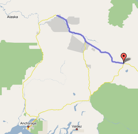
Tok, AK to Fairbanks, AK
Since the push from Tok to Fairbanks consisted only of 200 easy miles, we took our time getting going in the morning—we had some of the (unattended) continental breakfast at the Snowshoe (milk in a tub of ice, cereal in bins), packed at leisure, and left around 10:00. Immediately after Tok the thicker and taller forests returned, replacing the spindly taiga trees of the border area and Yukon highlands, and the highway condition was much improved too—we got a 65 mph limit and lots of extremely straight roads cut through unending flat forest country. The land gradually sloped down until we were in the Tanana River valley, which—though miles wide—had some escarpments along its edges rather like the Yukon. We got to Delta Junction, the official end of the Alaska Highway, around 11:30; we took the requisite photos of us in the heroes' posture on the End-of-the-Trail monument. Also got some appropriately cheesy souvenirs at the gift shop—bumper stickers, "We Made It" certificates, and the like. Then we pressed on. The Richardson Highway toward Fairbanks was in similarly good repair, and civilization was apparent everywhere, with homesteads and businesses (like the Knotty Shop, selling sculptures made of wood burl) everywhere we looked. True wilderness was rare in the final stretch, especially as we passed Eilson Air Force Base and the highway split to four lanes just in time to make North Pole, with its fast-food signs and exit ramps, look like a stop on I-5 in California. Just a little further on and we reached the first Fairbanks signs. We also realized with some dismay (and as was later confirmed to us) that the air in Fairbanks was so smoggy—or smoky—that we couldn't see a single mountain in the distance, or even tell how cloudy it was above. Turns out that there are a huge number of wildfires burning in Alaska at any given time; Fairbanks, in a low flat plain at the confluence of several major river valleys, is in a prime position to collect all the smoke. Bummer! But it's better than last summer, we're told, when 3/4 of the state was on fire. (The state, it seems, regards those scrubby little black spruces as a nuisance tree, and just lets them burn in the summer fires to encourage the growth of the willows that the moose and caribou like to eat. Nice idea, but they'll be waiting a long time before all those trees burn.)
So we got on Airport Way (the main retail drag) and began reconnoitering for motels. We'd managed to arrive at the beginning of a weekend, so accommodations were a bit harder to come by and more expensive than we'd hoped, but we were just about to check in at the $139 Best Western when we noticed another four-story hotel behind it, the Best Value Inn, which was $119 and had Net access (a brand-new addition; the owner proudly pointed to the wireless router stuck to the wall behind the front desk). A little funkier than the Best Western, with exposed pipes in the hallways and some carpet stains under the ice machines, but it had the necessities; and what's more it was a "sister hotel" of the Best Western, so we get to use the latter's laundry room and such. We checked in for four nights. Then we got a late Wendy's lunch, and lured by the big-city-sized Regal Cinemas next door, we stepped in and watched Charlie and the Chocolate Factory. After being thus suitably disarmed and de-stressed from the marathon drive, we unpacked in the room and settled in for a nice evening of chilling-out, and an early bedtime for the next day's 6:30 pickup by the van from River's Edge Resorts for the Barrow tour.